
The South Carolina Land Trust Network (SCLTN) unites land trusts to amplify the power of permanent land conservation.
Landowners
By protecting your land, you have a say in its future. You leave behind a legacy which remains with the land—forever.
1.3 Million Protected Acres and Counting
From the mountains to the sea, the river bottoms to the agricultural fields, South Carolina’s open spaces define our quality of life, shape our traditions, clean our water, and drive an $85 billion timber, farming, and tourism economy.
Together, South Carolina land trusts have collectively protected more than one million acres of land in our state.
Land Trust Staff
Within the SC Land Trust Network (LTN) members find an interconnected and encouraging community of like-minded people. We share not only the values of land protection, but also the idea that a unified group is stronger than one which stands alone.
Latest Stories and News
Application Instructions: Please email a cover letter, resume, and three (3) references in one PDF addressed to careers@lowcountrylandtrust.org by January 9, 2026. POSITION SUMMARY The Stewardship Associate II is a self-starter on the Conservation team, working to conserve and protect the Lowcountry of South Carolina. The work environment is dynamic and fast-paced, with a significant number of concurrent projects underway at all times. The Stewardship Associate II works in close partnership with the Stewardship Program Director and other Conservation staff to ensure all stewardship responsibilities on privately protected land and fee simple properties are met with the highest level of professionalism. RESPONSIBILITIES Monitor and steward a portfolio of protected land interests annually, developing landowner relationships, completing required annual monitoring reports thoroughly and timely, and providing prompt feedback to landowners and Stewardship staff. Property management and stewardship of fee simple properties, including two (2) current lessee-occupied working farms. Seasonal supervisor and mentor responsibilities for stewardship college intern(s). Respond to landowner and lessee inquiries and requests in a timely manner and in collaboration with the Stewardship Program Director. Assist the Stewardship Program Director and General Counsel in effectively and efficiently resolving emergent issues and potential or actual violations on protected properties, in accordance with accepted policies and procedures, and employing high sensitivity and professionalism. Oversee a subset of issues to resolution, including legal compliance, easement interpretations, and requests for amendments or discretionary consent. Maintain up-to-date records on activities occurring on protected lands, including documenting and detailing emails, meetings, phone calls, etc. Engage and educate landowners on stewardship and conservation opportunities, including land or resource management. Pursue continuing education and professional certifications as appropriate and/or as directed by the supervisor. Assist Conservation staff on special projects or project development as assigned by the supervisor. Work with staff on, and actively contribute to, achieving the strategic goals of the organization. Other Duties as Required: The above statements describe the general nature and level of work an employee assigned to this position performs. They are not to be construed as an exhaustive list of all responsibilities, duties, or skills required. All staff members may be required to perform duties outside of their normal responsibilities from time to time. Onboarding is in-person, and employees meet in person at least once per month for a staff meeting and occasionally throughout the year for staff group events. QUALIFICATIONS Required: Bachelor’s degree with experience in environmental or land conservation, resource management, or similar fields. Minimum of two (2) years of work experience preferred. Property or land management experience, with agricultural or farm experience preferred. Physical ability to travel to remote and undeveloped properties, hike/walk or otherwise travel in a variety of environmental conditions, and be outdoors for considerable periods of time. Valid driver’s license, proof of insurance, and regular access to reliable transportation. Ability to interpret and comprehend legal and technical documents. Demonstrated organizational skills managing multiple projects with the ability to move quickly from one to another while maintaining thorough records. Detail and goal-oriented, with the ability to exercise independent judgment in completing tasks, prioritizing, and meeting deadlines. Strong communication skills, both written and verbal, and the ability to confront challenges with utmost sensitivity and professionalism.. Familiarity with Google Workspace, Microsoft Office, and other business software; experience with conservation databases such as Landscape and Lens a plus. Positive attitude and willingness to accept a challenge. Demonstrated ability to work collaboratively with colleagues and partners. Physical ability to sit at a desk with a computer or in meetings for long periods. Lowcountry Land Trust is committed to the principles of equal employment opportunity, and to comply with all federal, state, and local laws that apply to equal employment. It is our policy to recruit, hire, train, and promote individuals, as well as administer any and all personnel actions, without regard to race, color, religion, creed, age, civil union status, domestic partnership status, affectional or sexual orientation or identity, sex, gender identity or expression, national origin or ancestry, marital status, status as a disabled or Vietnam era veteran, service in the federal or state military, union affiliation, pregnancy or breastfeeding, medical or genetic information, atypical hereditary cellular blood trait, refusal to submit to a genetic test or make test results available to the Company, or status as a qualified individual with a disability, in accordance with applicable laws. The Land Trust also complies with the South Carolina Pregnancy Accommodation Act. Benefits Summary Insurance Health Insurance CoPay Plan with FSA (Flexible Spending Account) option Employee premium covered 90% by employer HDHP (High Deductible) Plans with HSA (Health Savings Account) option All medical costs are paid out of pocket until the deductible is met Employee premium covered 100% by employer Includes Employer HSA contribution Dental Insurance – Employee premium covered 100% by employer Group Life Insurance with AD&D ($25,000) – Employee premium covered 100% by employer Disability - Employee premium covered 100% by employer Optional benefits available – Paid by Employee: Health FSA & Dependent Care FSA HSA Accident Insurance Critical Illness Coverage Vision Care Voluntary Life Insurance Financial & Retirement 403(b) Eligibility: Age 21 and works at least 83 1/3 hours per month Immediate eligibility Up to 6% match after 6 months of employment Family & Parenting Family & Medical Leave Hybrid Work Environment (in-office/from home) Flexible Hours Paid Time Off Self-managed PTO 11 Paid Holidays Flexible Summer Schedule Read more.
Application Instructions: Please email a cover letter, resume, and three (3) references in one PDF addressed to careers@lowcountrylandtrust.org by January 9, 2026. POSITION SUMMARY The Stewardship Associate II is a self-starter on the Conservation team, working to conserve and protect the Lowcountry of South Carolina. The work environment is dynamic and fast-paced, with a significant number of concurrent projects underway at all times. The Stewardship Associate II works in close partnership with the Stewardship Program Director and other Conservation staff to ensure all stewardship responsibilities on privately protected land and fee simple properties are met with the highest level of professionalism. RESPONSIBILITIES Monitor and steward a portfolio of protected land interests annually, developing landowner relationships, completing required annual monitoring reports thoroughly and timely, and providing prompt feedback to landowners and Stewardship staff. Property management and stewardship of fee simple properties, including two (2) current lessee-occupied working farms. Seasonal supervisor and mentor responsibilities for stewardship college intern(s). Respond to landowner and lessee inquiries and requests in a timely manner and in collaboration with the Stewardship Program Director. Assist the Stewardship Program Director and General Counsel in effectively and efficiently resolving emergent issues and potential or actual violations on protected properties, in accordance with accepted policies and procedures, and employing high sensitivity and professionalism. Oversee a subset of issues to resolution, including legal compliance, easement interpretations, and requests for amendments or discretionary consent. Maintain up-to-date records on activities occurring on protected lands, including documenting and detailing emails, meetings, phone calls, etc. Engage and educate landowners on stewardship and conservation opportunities, including land or resource management. Pursue continuing education and professional certifications as appropriate and/or as directed by the supervisor. Assist Conservation staff on special projects or project development as assigned by the supervisor. Work with staff on, and actively contribute to, achieving the strategic goals of the organization. Other Duties as Required: The above statements describe the general nature and level of work an employee assigned to this position performs. They are not to be construed as an exhaustive list of all responsibilities, duties, or skills required. All staff members may be required to perform duties outside of their normal responsibilities from time to time. Onboarding is in-person, and employees meet in person at least once per month for a staff meeting and occasionally throughout the year for staff group events. QUALIFICATIONS Required: Bachelor’s degree with experience in environmental or land conservation, resource management, or similar fields. Minimum of two (2) years of work experience preferred. Property or land management experience, with agricultural or farm experience preferred. Physical ability to travel to remote and undeveloped properties, hike/walk or otherwise travel in a variety of environmental conditions, and be outdoors for considerable periods of time. Valid driver’s license, proof of insurance, and regular access to reliable transportation. Ability to interpret and comprehend legal and technical documents. Demonstrated organizational skills managing multiple projects with the ability to move quickly from one to another while maintaining thorough records. Detail and goal-oriented, with the ability to exercise independent judgment in completing tasks, prioritizing, and meeting deadlines. Strong communication skills, both written and verbal, and the ability to confront challenges with utmost sensitivity and professionalism.. Familiarity with Google Workspace, Microsoft Office, and other business software; experience with conservation databases such as Landscape and Lens a plus. Positive attitude and willingness to accept a challenge. Demonstrated ability to work collaboratively with colleagues and partners. Physical ability to sit at a desk with a computer or in meetings for long periods. Lowcountry Land Trust is committed to the principles of equal employment opportunity, and to comply with all federal, state, and local laws that apply to equal employment. It is our policy to recruit, hire, train, and promote individuals, as well as administer any and all personnel actions, without regard to race, color, religion, creed, age, civil union status, domestic partnership status, affectional or sexual orientation or identity, sex, gender identity or expression, national origin or ancestry, marital status, status as a disabled or Vietnam era veteran, service in the federal or state military, union affiliation, pregnancy or breastfeeding, medical or genetic information, atypical hereditary cellular blood trait, refusal to submit to a genetic test or make test results available to the Company, or status as a qualified individual with a disability, in accordance with applicable laws. The Land Trust also complies with the South Carolina Pregnancy Accommodation Act. Benefits Summary Insurance Health Insurance CoPay Plan with FSA (Flexible Spending Account) option Employee premium covered 90% by employer HDHP (High Deductible) Plans with HSA (Health Savings Account) option All medical costs are paid out of pocket until the deductible is met Employee premium covered 100% by employer Includes Employer HSA contribution Dental Insurance – Employee premium covered 100% by employer Group Life Insurance with AD&D ($25,000) – Employee premium covered 100% by employer Disability - Employee premium covered 100% by employer Optional benefits available – Paid by Employee: Health FSA & Dependent Care FSA HSA Accident Insurance Critical Illness Coverage Vision Care Voluntary Life Insurance Financial & Retirement 403(b) Eligibility: Age 21 and works at least 83 1/3 hours per month Immediate eligibility Up to 6% match after 6 months of employment Family & Parenting Family & Medical Leave Hybrid Work Environment (in-office/from home) Flexible Hours Paid Time Off Self-managed PTO 11 Paid Holidays Flexible Summer Schedule
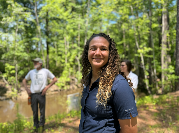
Lowcountry Land Trust proudly introduces Emelyn Talento, Land Trust Alliance Fellow and Community Lands Associate. Emelyn joins the Lowcountry Land Trust team thanks to a year-long fellowship through the Land Trust Alliance’s 2025 Scholars for Conservation Leadership Program. Read more.
