Land Legacy in McCormick County

September 1, 2024

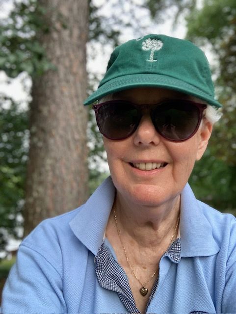
In McCormick County, near the banks of the upper Savannah River, 991.8 acres of undeveloped land will soon be protected by conservation easement. Ms. Della Coulter of Columbia, SC and a fifth-generation owner of the land, has partnered with the Upper Savannah Land Trust to obtain this easement and ensure her land legacy endures. 

How long has the property been in your family?

“We have a grant from King George III dated 1774 for 500 acres on the Savannah River made to John Deas. 


According to family lore, Ellington Searles put together about 6000 acres. He was a slave owner and grew cotton and had at least 100 enslaved people on his plantation at the close of the Civil War. At that time, he entered into a tenant farmer relationship with them.


After Ellington Searles, the land passed down in a female line to my mother.”


What did the land mean to you growing up? 
“My grandfather, Frank Robinson, moved his family from McCormick to Columbia when my mother was a teenager. She met my father there when they were in high school. After they were married, he spent most of his career in the Air Force, so we lived all over the country. But my mother had very strong roots in McCormick. So every summer, she would go back and take us as children. Our personal connection to the land was really staying in touch with the Black families that were still there.


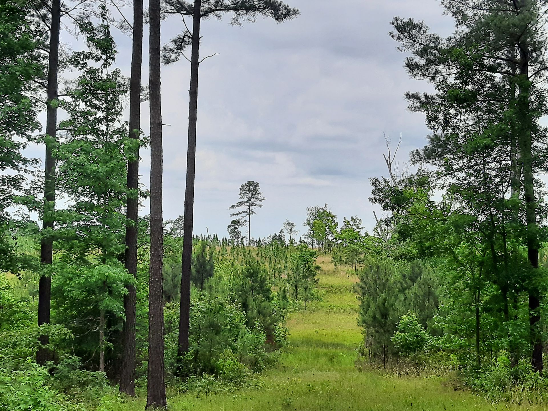
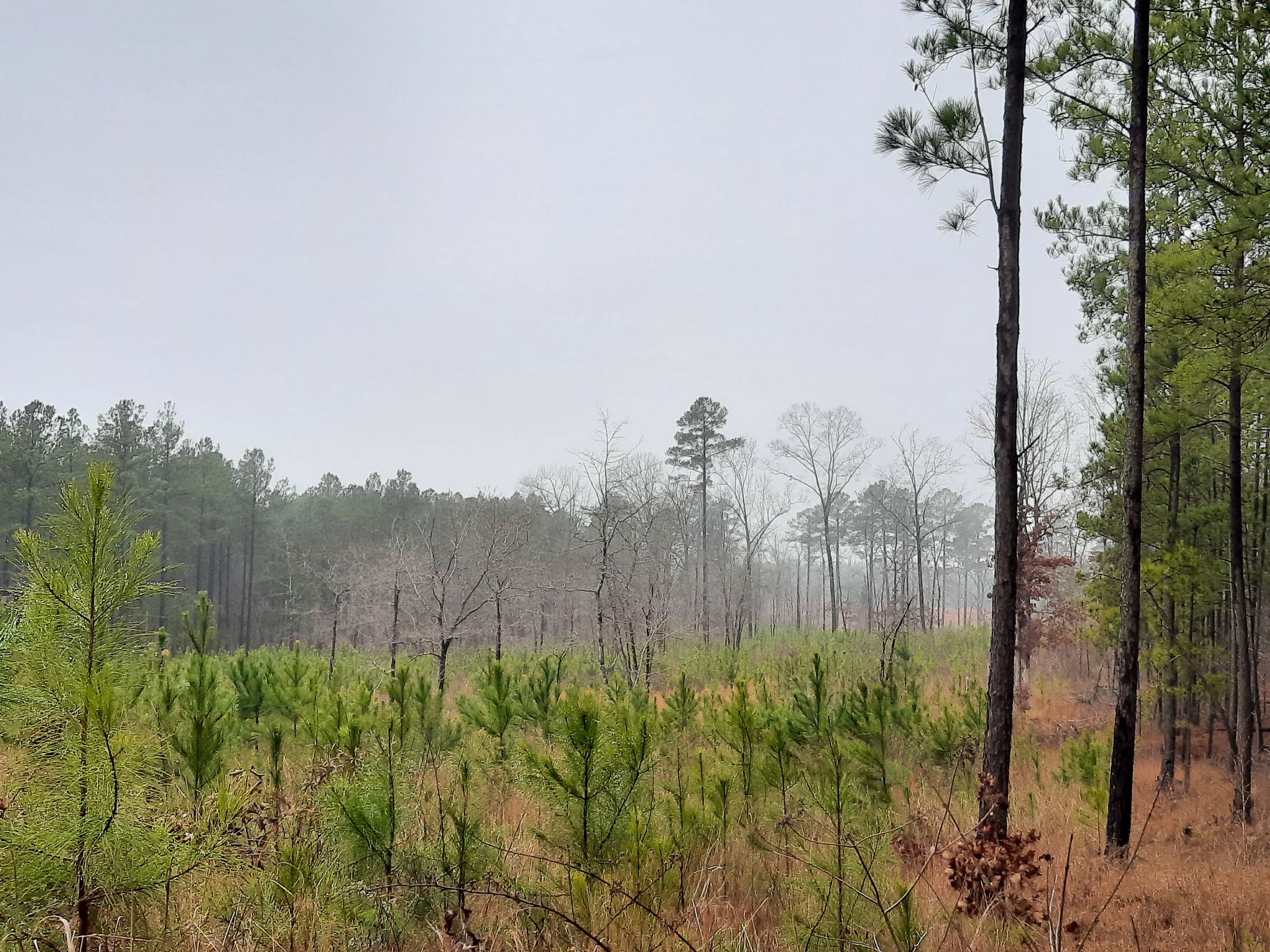
The Callaham family I personally knew. The Callaham sisters, Miss Willie Mae and Miss Mamie, were in their eighties when I first met them. They had grown up on the farm tended by their parents, had had “town jobs,” and then returned to their family’s farm in their later years. Miss Mamie told me that when she was a little girl, she could stand on their front porch and gaze out on cotton fields as far as the eye could see. By the 1930s, cotton had come and gone, and the family were subsistence farmers. The rest of the land pretty much went fallow into native pine, mostly loblolly.”


Since then, what have you used the land for? 
“It was in the 80s after my mother inherited the land that we got connected with procurement foresters and landowner liaisons with the Westvaco Cooperative Forest Management (CFM) program.


We started understanding that we could reforest—grow trees back after cutting. The more we worked with foresters, the more it seemed we could do something creative with the land—we could actually plant improved seedlings. 


After my mother died in 1997, I wanted to continue what she’d started in terms of more enlightened forestry. So, I started attending Clemson University’s Master Tree Farmer program and learned a tremendous amount from those folks.


On our property, we mainly worked with loblolly for a long time. We began an association with Thompson Forestry, and they recommended we start to do controlled burns. In the late 90s, my sister and I learned about the longleaf restoration projects in the Southeast. We planted 50 acres of longleaf in 2004 and 50 more in 2015. 


We’ve also leased our land to the Rocky River Hunt Club for about thirty years—they’re my eyes and ears on the land. We have turkey and deer. And since we’ve been burning, I’ve been told by our hunt club that they hear quail.”


How and why did you make the decision to protect? Why easement? 
“Since I’ve been managing it, I’ve gotten a couple offers a year to sell the land, so I knew it was there for the picking. 


When the Upper Savannah Land Trust was just getting started around 2000, I went to the initial meetings. I became more and more convinced that this was a good idea. I knew I’d be the last person in my family standing in South Carolina—and I don’t have any children. I thought I better be prepared in case no one wants to carry this on. 


My sister passed away and left her interest to me. With two-thirds ownership, I bought my brother out. I had to have sole-ownership of the land for one year before putting an easement on the property.”


Thinking about future, how does this make you feel?

“Extreme relief. I went out on quite a financial limb to buy my brother out. I was advised that, if I were to do this, I needed to have an exit strategy in case the loan went south. But soon I realized the goal of getting a conservation easement was my exit strategy—If I could get a conservation easement on this land, then I’d be fine with selling it, because it would be protected for generation after generation to enjoy. 


And thanks to the grant that the South Carolina Conservation Bank has given to the Upper Savannah, which will flow through to purchase part of the easement, I won’t have to sell. I can continue to manage the land, have the hunt club, work with my forester, and decide who to give the property to. That’s pretty cool.” 

June 13, 2025
The GIS & Conservation Planning Manager is a mission-driven, personable, and self-motivated individual. This position is critical to the successful and efficient function of the Conservation Department, in addition to serving as a cross-departmental resource for the organization. This GIS & Conservation Planning Manager is responsible for creating and managing all of the GIS (Geographic Information System) data, the ArcGIS Online web maps and the ArcGIS Field Maps app, the Landscape database portfolio and spatial data; and creating maps for prospective easements, legal documents, conservation value analysis, planning initiatives, and events. The work environment is dynamic and fast-paced, with a significant number of concurrent projects underway at all times. How to Apply: Application Instructions: To apply, please email a cover letter, resume, four (4) references (including someone who has supervised you), and three (3) examples of mapping created personally by you; in one PDF addressed to careers@lowcountrylandtrust.org . To learn more, click here.
June 6, 2025
The GIS & Conservation Planning Manager is a mission-driven, personable, and self-motivated individual. This position is critical to the successful and efficient function of the Conservation Department, in addition to serving as a cross-departmental resource for the organization. This GIS & Conservation Planning Manager is responsible for creating and managing all of the GIS (Geographic Information System) data, the ArcGIS Online web maps and the ArcGIS Field Maps app, the Landscape database portfolio and spatial data; and creating maps for prospective easements, legal documents, conservation value analysis, planning initiatives, and events. The work environment is dynamic and fast-paced, with a significant number of concurrent projects underway at all times. How to Apply: Application Instructions: To apply, please email a cover letter, resume, four (4) references (including someone who has supervised you), and three (3) examples of mapping created personally by you; in one PDF addressed to careers@lowcountrylandtrust.org . To learn more, click here.
May 29, 2025
Dorchester County donated $4,125,000 in Greenbelt funds to the Open Space Institute towards the purchase of the Beech Hill Tract, a 1,644-acre property on Old Beech Hill Road between the Edisto River Wildlife Management Area and Givhan’s Ferry State Park in the East Edisto area of Dorchester County. The property will be transferred to the South Carolina Forestry Commission (SCFC) and will become a State Forest, managed and operated by the SCFC. The property will be open to the public with recreational opportunities, such as wildlife viewing, hunting, hiking, and biking.  Read the full story on the Dorchester County website.
May 20, 2025
Greenville County's Historic & Natural Resources Trust partnered with the Community Foundation of Greenville to survey voters about their views on use of their tax dollars to protect open space. The results were overwhelmingly positive: Controlling growth and development topped the list of concerns; 91% were concerned about loss of open space; and 93.3% supported keeping funding at $2Million/year with a whopping 66% saying, invest more! Read the survey on the Greenville Historic and Natural Resources Trust website.
May 14, 2025
Jasper County’s Chelsea Plantation – the site of a proposed development that drew widespread, vocal opposition from citizens throughout the Lowcountry – has been purchased for conservation. The Nature Conservancy in South Carolina (TNC-SC) today announced the acquisition of the 2,737-acre property, identified as a high priority for conservation and under significant threat of development. Read the full story on The Nature Conservancy website.
May 6, 2025
Lowcountry Land Trust is excited to announce the permanent protection of the 35-acre Holly Grove property, which will serve as an official addition to the Caw Caw Interpretive Center in Ravenel, South Carolina. In collaboration with the Charleston County Parks and Recreation Commission (CCPRC), this strategic acquisition expands public access to nature, enhances water quality, and ensures the long-term conservation of vital habitats in one of Charleston County’s most ecologically and recreationally valuable public spaces. Read the full story on the Lowcountry Land Trust website .
April 21, 2025
Lowcountry Land Trust is proud to announce the permanent protection of an additional portion of Fairfield Plantation—an ecologically rich and historically significant property located on the South Santee River at the gateway to Charleston County along both sides of U.S. Highway 17. Read the full story on the Lowcountry Land Trust website.
March 31, 2025
The island consists of 28 acres of upland habitat surrounded by 393 acres of salt marsh. Thanks to a fully donated conservation easement, this pristine landscape will continue to support thriving wildlife, clean waterways, and the natural beauty of the Lowcountry. Read the full story on the Lowcountry Land Trust website.
March 15, 2025
This March, the Open Land Trust completed a project in partnership with the Rhodes family and key partner organizations to permanently protect 900 acres of their family land in the heart of the Ashepoo-Combahee-Edisto (ACE) Basin. This property known as Essex Farms includes 2.3 miles of river frontage, highly productive farm and forest land, and plays a vital role in maintaining the rural character of the Dale community in northern Beaufort County. Read the full story on the Open Land Trust website.
March 12, 2025
The property features a high bluff overlooking the Ashley River and contains significant wetlands and wildlife habitat. It contributes to the longstanding effort to conserve land of cultural, historical, and ecological importance in the 24,000-acre Ashley River Historic District. Read the full story on the Lowcountry Land Trust website.
More Posts